Current Local Time in Redlynch, Queensland, Australia
12:58:26
Thursday, 24 July 2025
| Country: | Australia |
| State: | Queensland (Qld) |
| Languages: | English |
| Currency: | Australian Dollar (AUD) |
| Lat/Long: | 16.9005°S / 145.6983°E |
| Elevation: | 11 m |
| Country Code: | +61 |
Weather
°C
Change Units for Weather
Now

Overcast
28 °C
Fri, 25

Patchy rain nearby
26 / 20 °C
Sat, 26

Partly Cloudy
26 / 20 °C
Sun, 27

Sunny
26 / 19 °C
Time Zone


No DST
No Daylight Saving Time in 2025
Sun & Moon

Sunrise
06:45

Sunset
18:02

Day length
11 hours, 16 minutes +34s longer

Moon 1%
Rise - 06:09 Set - 17:27
Time Zone ConverterCompare the local time of two time zones, countries or cities of the world |  |
Redlynch
Time Difference to major World Cities
Upcoming Holidays
Wednesday, August 13, 2025 Royal National Agricultural Show Day (Ekka)
Monday, October 6, 2025 King's Birthday
Wednesday, December 24, 2025 Christmas Eve
Thursday, December 25, 2025 Christmas Day
Friday, December 26, 2025 Boxing Day
Airports
Cairns International Airport, CNS About 6 km from Redlynch
Mareeba Airport, MRG About 35 km from Redlynch
Cooktown Airport, CTN About 171 km from Redlynch
Townsville Airport, TSV About 285 km from Redlynch
Coen Airport, CUQ About 446 km from Redlynch
See on the Map
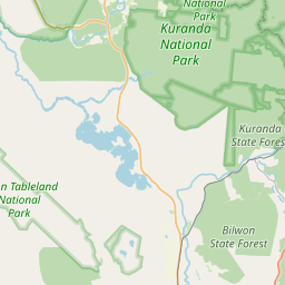
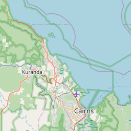


Major cities in the vicinity of Redlynch, Australia
Cairns ... (8 Km)
Townsville ... (288 Km)
Mackay ... (597 Km)
Mount Isa ... (779 Km)
Port Moresby ... (845 Km)
Rockhampton ... (878 Km)
Alotau ... (895 Km)
Popondetta ... (946 Km)
Gladstone ... (964 Km)
Merauke ... (1096 Km)
Bundaberg ... (1123 Km)
Lae ... (1141 Km)
Mount Hagen ... (1238 Km)
Sunshine Coast ... (1324 Km)
Note: The distance between two locations is provided as an aerial distance for informational purposes only. While approximate, this calculation is based on reliable data and may vary slightly from the actual distance as reported in official forecasts and advisories.


