Current Local Time in Conceição do Almeida, Bahia, Brazil
11:41:03
Sunday, 27 July 2025
| Country: | Brazil |
| State: | Bahia (BA) |
| Languages: | Portuguese |
| Currency: | Real (BRL) |
| Lat/Long: | 12.7794°S / 39.1700°W |
| Elevation: | 179 m |
| Country Code: | +55 |
Weather
°C
Change Units for Weather
Now

Sunny
27 °C
Mon, 28

Patchy rain nearby
29 / 18 °C
Tue, 29

Partly Cloudy
30 / 16 °C
Wed, 30
Partly Cloudy
29 / 17 °C
Time Zone


No DST
No Daylight Saving Time in 2025
Sun & Moon

Sunrise
05:57

Sunset
17:28

Day length
11 hours, 30 minutes +26s longer

Moon 6%
Rise - 08:03 Set - 20:08
Time Zone ConverterCompare the local time of two time zones, countries or cities of the world |  |
Conceição do Almeida
Time Difference to major World Cities
Upcoming Holidays
Sunday, September 7, 2025 Independence Day
Sunday, October 12, 2025 Our Lady of Aparecida / Children's Day
Tuesday, October 28, 2025 Public Service Holiday
Sunday, November 2, 2025 All Souls' Day
Saturday, November 15, 2025 Republic Proclamation Day
Airports
Salvador – Deputado Luís Eduardo Magalhães International Airport, SSA About 93 km from Conceição do Almeida
Bahia - Jorge Amado Airport, IOS About 227 km from Conceição do Almeida
Glauber de Andrade Rocha Airport, VDC About 302 km from Conceição do Almeida
Aracaju - Santa Maria International Airport, AJU About 303 km from Conceição do Almeida
Paulo Afonso Airport, PAV About 389 km from Conceição do Almeida
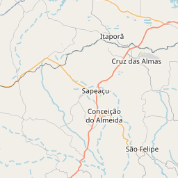
See on the Map
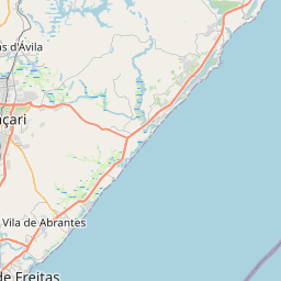

Major cities in the vicinity of Conceição do Almeida, Brazil
Feira de Santana ... (63 Km)
Salvador ... (76 Km)
Jequié ... (156 Km)
Itabuna ... (224 Km)
Ilhéus ... (225 Km)
Vitória da Conquista ... (294 Km)
Aracaju ... (307 Km)
Porto Seguro ... (408 Km)
Maceió ... (510 Km)
Teixeira de Freitas ... (533 Km)
Teófilo Otoni ... (618 Km)
Barreiras ... (636 Km)
Januária ... (636 Km)
Montes Claros ... (669 Km)
Recife ... (704 Km)
Luís Eduardo Magalhães ... (722 Km)
Governador Valadares ... (738 Km)
João Pessoa ... (785 Km)
Vitória ... (848 Km)
Note: The distance between two locations is provided as an aerial distance for informational purposes only. While approximate, this calculation is based on reliable data and may vary slightly from the actual distance as reported in official forecasts and advisories.


