Current Local Time in Mompós, Colombia (Santa Cruz de Mompox)
1
2
3
4
5
6
7
8
9
10
11
12
14:31:05
Tuesday, 24 June 2025
| Country: | Colombia |
| Department: | Bolívar |
| Languages: | Spanish |
| Currency: | Colombian Peso (COP) |
| Lat/Long: | 9.2397°N / 74.4254°W |
| Elevation: | 33 m |
| Country Code: | +57 |
| Holiday Note: Jun 30 - Sacred Heart. The Businesses may be closed. |
Weather
°C
Change Units for Weather
Now

Patchy rain nearby
30 °C
Wed, 25
Patchy rain nearby
31 / 24 °C
Thu, 26
Patchy rain nearby
33 / 23 °C
Fri, 27

Moderate rain
32 / 23 °C
Time Zone

Time Zone
COT (Colombia Time) GMT/UTC -5 hours

No DST
No Daylight Saving Time in 2025
Sun & Moon

Sunrise
05:40

Sunset
18:19

Day length
12 hours, 39 minutes
-3s shorter

Moon 3%
Rise - 04:37
Set - 17:51
Time Zone ConverterCompare the local time of two time zones, countries or cities of the world |  |
Mompós
Time Difference to major World Cities
Upcoming Holidays
Monday, June 30, 2025 Sacred Heart
Sunday, July 20, 2025 Independence Day
Thursday, August 7, 2025 Battle of Boyacá Day
Monday, August 18, 2025 Assumption Day
Monday, October 13, 2025 Columbus Day
Airports
Baracoa Airport, MGN About 46 km from Mompós
Las Flores Airport, ELB About 54 km from Mompós
Las Brujas Airport, CZU About 95 km from Mompós
Coveñas Airport, CVE About 140 km from Mompós
Aguas Claras Airport, OCV About 156 km from Mompós
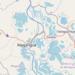
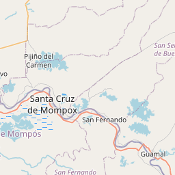
See on the Map

Major cities in the vicinity of Mompós, Colombia
Montería ... (169 Km)
Cartagena ... (173 Km)
Valledupar ... (188 Km)
Barranquilla ... (198 Km)
Cúcuta ... (260 Km)
Bucaramanga ... (276 Km)
San Cristóbal ... (292 Km)
Riohacha ... (304 Km)
El Vigía ... (312 Km)
Maicao ... (337 Km)
Maracaibo ... (343 Km)
Cabimas ... (350 Km)
Medellín ... (356 Km)
Ciudad Ojeda ... (358 Km)
Mérida ... (364 Km)
Valera ... (420 Km)
Barinas ... (465 Km)
Yopal ... (488 Km)
Bogotá ... (505 Km)
Pereira ... (512 Km)
Guanare ... (515 Km)
Punto Fijo ... (538 Km)
Ibagué ... (541 Km)
Panama City ... (560 Km)
Barquisimeto ... (566 Km)
Coro ... (572 Km)
Villavicencio ... (574 Km)
Acarigua ... (575 Km)
La Chorrera ... (589 Km)
Colón ... (601 Km)
Note: The distance between two locations is provided as an aerial distance for informational purposes only. While approximate, this calculation is based on reliable data and may vary slightly from the actual distance as reported in official forecasts and advisories.