Current Local Time in Chalatenango, El Salvador
19:57:24
Friday, 25 July 2025
| Country: | El Salvador |
| Department: | Chalatenango |
| Languages: | Spanish |
| Currency: | United States Dollar (USD) |
| Lat/Long: | 14.0412°N / 88.9395°W |
| Elevation: | 396 m |
| Country Code: | +503 |
Weather
°C
Change Units for Weather
Now

Patchy rain nearby
22 °C
Sat, 26

Moderate rain
30 / 19 °C
Sun, 27

Patchy rain nearby
30 / 19 °C
Mon, 28
Moderate rain
30 / 18 °C
Time Zone


No DST
No Daylight Saving Time in 2025
Sun & Moon

Sunrise
05:38

Sunset
18:26

Day length
12 hours, 47 minutes -30s shorter

Moon 0%
Rise - 06:23 Set - 19:29
Time Zone ConverterCompare the local time of two time zones, countries or cities of the world |  |
Chalatenango
Time Difference to major World Cities
Upcoming Holidays
Wednesday, August 6, 2025 Celebrations of San Salvador
Monday, September 15, 2025 Independence Day
Sunday, November 2, 2025 All Saints' Day
Thursday, December 25, 2025 Christmas Day
Thursday, January 1, 2026 New Year's Day
Airports
El Salvador International Airport, SAL About 68 km from Chalatenango
Palmerola International Airport, XPL About 147 km from Chalatenango
La Aurora Airport, GUA About 181 km from Chalatenango
Toncontín International Airport, TGU About 186 km from Chalatenango
Ramón Villeda Morales International Airport, SAP About 191 km from Chalatenango
See on the Map
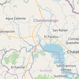

Major cities in the vicinity of Chalatenango, El Salvador
San Salvador ... (47 Km)
Santa Ana ... (67 Km)
La Libertad ... (74 Km)
Sonsonate ... (92 Km)
Usulután ... (94 Km)
Ahuachapán ... (98 Km)
San Miguel ... (103 Km)
Chiquimula ... (107 Km)
Acajutla ... (108 Km)
Zacapa ... (121 Km)
Santa Rosa de Lima ... (122 Km)
La Unión ... (142 Km)
Comayagua ... (146 Km)
Guatemala City ... (183 Km)
Tegucigalpa ... (186 Km)
Puerto Barrios ... (190 Km)
San Pedro Sula ... (191 Km)
El Progreso ... (193 Km)
Antigua Guatemala ... (202 Km)
Cobán ... (222 Km)
Chinandega ... (252 Km)
Danlí ... (256 Km)
Mazatenango ... (282 Km)
León ... (286 Km)
Quetzaltenango ... (292 Km)
Estelí ... (298 Km)
La Ceiba ... (300 Km)
Juticalpa ... (301 Km)
Huehuetenango ... (307 Km)
Flores ... (336 Km)
Note: The distance between two locations is provided as an aerial distance for informational purposes only. While approximate, this calculation is based on reliable data and may vary slightly from the actual distance as reported in official forecasts and advisories.


