Current Local Time in Ntoum, Gabon (Nkan)
00:21:54
Sunday, 20 July 2025
| Country: | Gabon |
| Province: | Estuaire |
| Languages: | French |
| Currency: | Central African CFA Franc (XAF) |
| Lat/Long: | 0.3844°N / 9.7539°E |
| Elevation: | 34 m |
| Country Code: | +241 |
Weather
°C
Change Units for Weather
Now

Overcast
24 °C
Mon, 21

Patchy rain nearby
26 / 23 °C
Tue, 22
Patchy rain nearby
26 / 23 °C
Wed, 23
Patchy rain nearby
25 / 22 °C
Time Zone


No DST
No Daylight Saving Time in 2025
Sun & Moon

Sunrise
06:23

Sunset
18:31

Day length
12 hours, 07 minutes -1s shorter

Moon 28%
Rise - 01:53 Set - 14:22
Time Zone ConverterCompare the local time of two time zones, countries or cities of the world |  |
Ntoum
Time Difference to major World Cities
Upcoming Holidays
Friday, August 15, 2025 Assumption Day
Saturday, August 16, 2025 Independence Day
Sunday, August 17, 2025 Independence Day
Saturday, November 1, 2025 All Saints' Day
Thursday, December 25, 2025 Christmas Day
Airports
Libreville Leon M'ba International Airport, LBV About 39 km from Ntoum
Lambarene Airport, LBQ About 133 km from Ntoum
Port Gentil Airport, POG About 165 km from Ntoum
Bata Airport, BSG About 169 km from Ntoum
Omboue Hospital Airport, OMB About 225 km from Ntoum
See on the Map
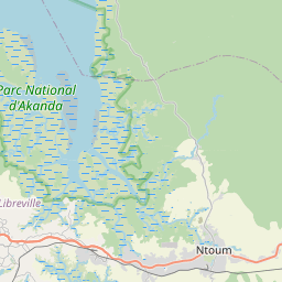
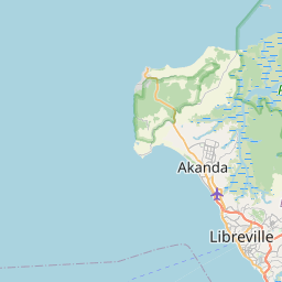


Major cities in the vicinity of Ntoum, Gabon
Libreville ... (33 Km)
Port-Gentil ... (167 Km)
São Tomé ... (336 Km)
Makokou ... (346 Km)
Luba ... (367 Km)
Malabo ... (390 Km)
Tchibanga ... (393 Km)
Douala ... (408 Km)
Buea ... (423 Km)
Yaoundé ... (434 Km)
Franceville ... (482 Km)
Bafoussam ... (571 Km)
Port Harcourt ... (577 Km)
Dolisie ... (604 Km)
Pointe-Noire ... (622 Km)
Bamenda ... (622 Km)
Bertoua ... (638 Km)
Kayes ... (641 Km)
Djambala ... (644 Km)
Owerri ... (644 Km)
Makoua ... (653 Km)
Owando ... (689 Km)
Ouésso ... (713 Km)
Enugu ... (720 Km)
Warri ... (723 Km)
Asaba ... (727 Km)
Berbérati ... (797 Km)
Brazzaville ... (799 Km)
Matadi ... (804 Km)
Note: The distance between two locations is provided as an aerial distance for informational purposes only. While approximate, this calculation is based on reliable data and may vary slightly from the actual distance as reported in official forecasts and advisories.


