Current Local Time in Dumka, Bihar, India
1
2
3
4
5
6
7
8
9
10
11
12
23:59:29
Thursday, 3 July 2025
| Country: | India |
| State: | Bihar (BR) |
| Languages: | Hindi, Urdu, Maithili, Magahi, Bhojpuri |
| Currency: | Indian Rupee (INR) |
| Lat/Long: | 24.2685°N / 87.2488°E |
| Elevation: | 137 m |
| Country Code: | +91 |
| Holiday Note: Jul 06 - Muharram (Ashura). The Businesses may be closed. Learn More |
Weather
°C
Change Units for Weather
Now

Patchy rain nearby
28 °C
Fri, 4

Heavy rain
30 / 27 °C
Sat, 5

Moderate rain
30 / 25 °C
Sun, 6
Moderate rain
30 / 25 °C
Time Zone


No DST
No Daylight Saving Time in 2025
Sun & Moon

Sunrise
04:57

Sunset
18:33

Day length
13 hours, 35 minutes -21s shorter

Moon 61%
Rise - 13:00 Set - 00:00
Time Zone ConverterCompare the local time of two time zones, countries or cities of the world |  |
Dumka
Time Difference to major World Cities
Upcoming Holidays
Sunday, July 6, 2025 Muharram (Ashura)
Saturday, August 9, 2025 Raksha Bandhan (Rakhi)
Friday, August 15, 2025 Independence Day
Friday, August 15, 2025 Janmashtami (Smarta)
Friday, August 15, 2025 Parsi New Year
Airports
Kazi Nazrul Islam Airport, RDP About 72 km from Dumka
Shah Mokhdum Airport, RJH About 140 km from Dumka
Ishurdi Airport, IRD About 183 km from Dumka
Netaji Subhash Chandra Bose International Airport, CCU About 217 km from Dumka
Birsa Munda Airport, IXR About 223 km from Dumka
See on the Map

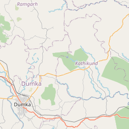

Major cities in the vicinity of Dumka, India
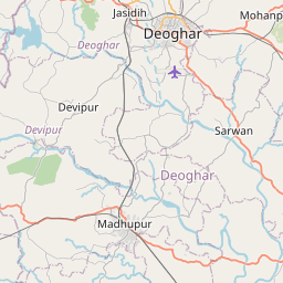
Deoghar ... (61 Km)
Durgapur ... (83 Km)
Dhanbad ... (98 Km)
Berhampore ... (105 Km)
Bhagalpur ... (112 Km)
Malda ... (122 Km)
Bokaro ... (130 Km)
Bardhaman ... (131 Km)
Rajshahi ... (137 Km)
Katihar ... (146 Km)
Purnia ... (169 Km)
Hazaribagh ... (194 Km)
Dinajpur ... (206 Km)
Kishanganj ... (215 Km)
Kolkata ... (220 Km)
Ranchi ... (220 Km)
Bogra ... (224 Km)
Gaya ... (235 Km)
Biratnagar ... (243 Km)
Darbhanga ... (250 Km)
Patna ... (259 Km)
Rangpur ... (260 Km)
Baripada ... (265 Km)
Muzaffarpur ... (278 Km)
Jamalpur ... (282 Km)
Lahan ... (282 Km)
Khulna ... (285 Km)
Digha ... (295 Km)
Siliguri ... (297 Km)
Chapra ... (302 Km)
Note: The distance between two locations is provided as an aerial distance for informational purposes only. While approximate, this calculation is based on reliable data and may vary slightly from the actual distance as reported in official forecasts and advisories.