Current Local Time in Galesong, South Sulawesi, Indonesia
04:41:30
Monday, 28 July 2025
| Country: | Indonesia |
| Province: | South Sulawesi |
| Languages: | Indonesian |
| Currency: | Indonesian Rupiah (IDR) |
| Lat/Long: | 5.3200°S / 119.3662°E |
| Elevation: | 13 m |
| Country Code: | +62 |
Weather
°C
Change Units for Weather
Now

Clear
23 °C
Tue, 29

Sunny
31 / 24 °C
Wed, 30
Sunny
31 / 23 °C
Thu, 31

Patchy rain nearby
31 / 24 °C
Time Zone


No DST
No Daylight Saving Time in 2025
Sun & Moon

Sunrise
06:13

Sunset
18:05

Day length
11 hours, 51 minutes +12s longer

Moon 11%
Rise - 08:46 Set - 21:03
Time Zone ConverterCompare the local time of two time zones, countries or cities of the world |  |
Galesong
Time Difference to major World Cities
Upcoming Holidays
Sunday, August 17, 2025 Independence Day
Friday, September 5, 2025 Maulid Nabi Muhammad
Thursday, December 25, 2025 Christmas Day
Friday, December 26, 2025 Boxing Day
Thursday, January 1, 2026 New Year's Day
Airports
Hasanuddin International Airport, UPG About 35 km from Galesong
Toraja Airport, TRT About 245 km from Galesong
Kasiguncu Airport, PSJ About 457 km from Galesong
Matahora Airport, WNI About 473 km from Galesong
Mutiara - SIS Al-Jufrie Airport, PLW About 493 km from Galesong
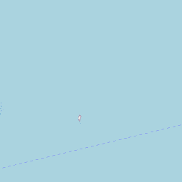
See on the Map
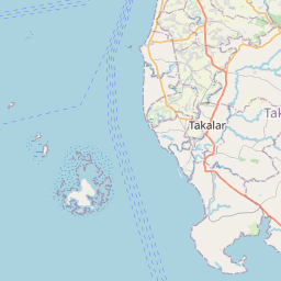


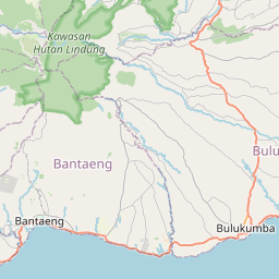

Major cities in the vicinity of Galesong, Indonesia
Makassar ... (21 Km)
Parepare ... (149 Km)
Palopo ... (274 Km)
Kolaka ... (285 Km)
Kendari ... (378 Km)
Balikpapan ... (533 Km)
Banjarmasin ... (574 Km)
Denpasar ... (590 Km)
Samarinda ... (591 Km)
Kalabahi ... (654 Km)
Palangka Raya ... (696 Km)
Kupang ... (713 Km)
Surabaya ... (763 Km)
Dili ... (773 Km)
Sampit ... (775 Km)
Suai ... (787 Km)
Malang ... (800 Km)
Baucau ... (857 Km)
Note: The distance between two locations is provided as an aerial distance for informational purposes only. While approximate, this calculation is based on reliable data and may vary slightly from the actual distance as reported in official forecasts and advisories.


