Current Local Time in Ridder, Kazakhstan
10:41:21
Tuesday, 22 July 2025
| Country: | Kazakhstan |
| Region: | East Kazakhstan |
| Languages: | Kazakh, Russian |
| Currency: | Tenge (KZT) |
| Lat/Long: | 50.3382°N / 83.5063°E |
| Elevation: | 730 m |
| Country Code: | +7 |
| Alternative Names: | Leninogorsk |
Weather
°C
Change Units for Weather
Now

Sunny
16 °C
Wed, 23
Sunny
20 / 3 °C
Thu, 24
Sunny
21 / 2 °C
Fri, 25
Sunny
25 / 6 °C
Time Zone


No DST
No Daylight Saving Time in 2025
Sun & Moon

Sunrise
03:41

Sunset
19:23

Day length
15 hours, 42 minutes -2m 28s shorter

Moon 10%
Rise - 01:00 Set - 19:08
Time Zone ConverterCompare the local time of two time zones, countries or cities of the world |  |
Ridder
Time Difference to major World Cities
Upcoming Holidays
Saturday, August 30, 2025 Constitution Day
Monday, September 1, 2025 Day off for Constitution Day
Saturday, October 25, 2025 Republic Day
Tuesday, December 16, 2025 Independence Day
Thursday, January 1, 2026 New Year's Day
Airports
Ust-Kamenogorsk Airport, UKK About 80 km from Ridder
Semipalatinsk Airport, PLX About 232 km from Ridder
Gorno-Altaysk Airport, RGK About 243 km from Ridder
Barnaul Airport, BAX About 336 km from Ridder
Burqin Kanas Airport, KJI About 346 km from Ridder
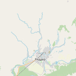
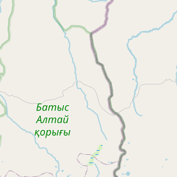
See on the Map

Major cities in the vicinity of Ridder, Kazakhstan
Oskemen ... (77 Km)
Semey ... (231 Km)
Gorno-Altaysk ... (248 Km)
Barnaul ... (335 Km)
Altay ... (437 Km)
Prokopyevsk ... (451 Km)
Novokuznetsk ... (454 Km)
Ölgii ... (489 Km)
Pavlodar ... (503 Km)
Novosibirsk ... (525 Km)
Karasuk ... (530 Km)
Karamay ... (539 Km)
Kemerovo ... (582 Km)
Kupino ... (615 Km)
Khovd ... (646 Km)
Abakan ... (659 Km)
Tomsk ... (690 Km)
Karagandy ... (744 Km)
Ürümqi ... (788 Km)
Astana ... (854 Km)
Note: The distance between two locations is provided as an aerial distance for informational purposes only. While approximate, this calculation is based on reliable data and may vary slightly from the actual distance as reported in official forecasts and advisories.


