Current Local Time in Homa Bay, Kenya
17:13:22
Wednesday, 23 July 2025
| Country: | Kenya |
| County: | Homa Bay |
| Languages: | Swahili, English |
| Currency: | Kenyan Shilling (KES) |
| Lat/Long: | 0.535°S / 34.4531°E |
| Elevation: | 1131 m |
| Country Code: | +254 |
Weather
°C
Change Units for Weather
Now

Partly cloudy
21 °C
Thu, 24

Patchy rain nearby
24 / 13 °C
Fri, 25
Patchy rain nearby
25 / 14 °C
Sat, 26
Patchy rain nearby
24 / 13 °C
Time Zone


No DST
No Daylight Saving Time in 2025
Sun & Moon

Sunrise
06:46

Sunset
18:51

Day length
12 hours, 05 minutes +1s longer

Moon 4%
Rise - 05:16 Set - 17:43
Time Zone ConverterCompare the local time of two time zones, countries or cities of the world |  |
Homa Bay
Time Difference to major World Cities
Upcoming Holidays
Friday, October 10, 2025 Mazingira Day
Monday, October 20, 2025 Mashujaa Day
Friday, December 12, 2025 Jamhuri Day
Thursday, December 25, 2025 Christmas Day
Friday, December 26, 2025 Boxing Day
Airports
Kisumu Airport, KIS About 59 km from Homa Bay
Mara Serena Lodge Airstrip, MRE About 115 km from Homa Bay
Eldoret International Airport, EDL About 136 km from Homa Bay
Kitale Airport, KTL About 177 km from Homa Bay
Entebbe International Airport, EBB About 232 km from Homa Bay
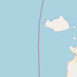
See on the Map


Major cities in the vicinity of Homa Bay, Kenya
Kisii ... (38 Km)
Kisumu ... (60 Km)
Kakamega ... (97 Km)
Bungoma ... (123 Km)
Eldoret ... (148 Km)
Nakuru ... (181 Km)
Kitale ... (183 Km)
Naivasha ... (222 Km)
Kampala ... (229 Km)
Nairobi ... (276 Km)
Mwanza ... (280 Km)
Nanyuki ... (297 Km)
Lira ... (354 Km)
Meru ... (361 Km)
Kitui ... (406 Km)
Hoima ... (408 Km)
Mbarara ... (422 Km)
Lodwar ... (426 Km)
Gulu ... (440 Km)
Fort Portal ... (483 Km)
Kigali ... (513 Km)
Bunia ... (522 Km)
Muyinga ... (524 Km)
Tabora ... (531 Km)
Musanze ... (546 Km)
Arua ... (559 Km)
Beni ... (568 Km)
Butembo ... (577 Km)
Garissa ... (577 Km)
Torit ... (588 Km)
Note: The distance between two locations is provided as an aerial distance for informational purposes only. While approximate, this calculation is based on reliable data and may vary slightly from the actual distance as reported in official forecasts and advisories.


