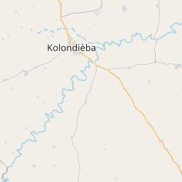
Current Local Time in Kolondiéba, Mali
06:42:47
Wednesday, 23 July 2025
| Country: | Mali |
| Region: | Sikasso |
| Languages: | Bambara, Bobo, Bozo, French |
| Currency: | West African CFA Franc (XOF) |
| Lat/Long: | 11.0915°N / 6.8914°W |
| Elevation: | 332 m |
| Country Code: | +223 |
Weather
°C
Change Units for Weather
Now

Heavy rain
21 °C
Thu, 24

Patchy rain nearby
29 / 21 °C
Fri, 25
Patchy rain nearby
30 / 21 °C
Sat, 26

Moderate rain
29 / 22 °C
Time Zone


No DST
No Daylight Saving Time in 2025
Sun & Moon

Sunrise
06:14

Sunset
18:53

Day length
12 hours, 39 minutes -23s shorter

Moon 4%
Rise - 04:44 Set - 18:02
Time Zone ConverterCompare the local time of two time zones, countries or cities of the world |  |
Kolondiéba
Time Difference to major World Cities
Upcoming Holidays
Friday, September 5, 2025 The Prophet's Birthday
Friday, September 12, 2025 Baptism of the Prophet
Monday, September 22, 2025 Independence Day
Thursday, December 25, 2025 Christmas Day
Airports
Modibo Keita International Airport, BKO About 197 km from Kolondiéba
Korhogo Airport, HGO About 239 km from Kolondiéba
Bobo Dioulasso Airport, BOY About 279 km from Kolondiéba
Bouaké Airport, BYK About 423 km from Kolondiéba
Man Airport, MJC About 432 km from Kolondiéba
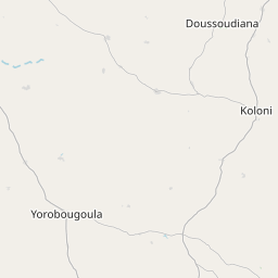
See on the Map

Major cities in the vicinity of Kolondiéba, Mali
Sikasso ... (133 Km)
Bamako ... (210 Km)
Koutiala ... (210 Km)
Korhogo ... (228 Km)
Ferkessédougou ... (250 Km)
Siguiri ... (252 Km)
Ségou ... (269 Km)
Kankan ... (276 Km)
Bobo-Dioulasso ... (284 Km)
Niono ... (362 Km)
Dédougou ... (403 Km)
Kissidougou ... (410 Km)
Man ... (416 Km)
Nzérékoré ... (428 Km)
Bouaké ... (429 Km)
Voinjama ... (432 Km)
Danané ... (448 Km)
Daloa ... (470 Km)
Mopti ... (478 Km)
Ganta ... (486 Km)
Duékoué ... (487 Km)
Yamoussoukro ... (507 Km)
Guiglo ... (509 Km)
Koudougou ... (511 Km)
Koidu ... (523 Km)
Gbarnga ... (536 Km)
Ouahigouya ... (559 Km)
Bondoukou ... (561 Km)
Gagnoa ... (561 Km)
Mamou ... (573 Km)
Note: The distance between two locations is provided as an aerial distance for informational purposes only. While approximate, this calculation is based on reliable data and may vary slightly from the actual distance as reported in official forecasts and advisories.


