Current Local Time in Bouéni, Mayotte
23:47:18
Tuesday, 22 July 2025
| Country: | France |
| Overseas Department: | Mayotte |
| Languages: | French |
| Currency: | Euro (EUR) |
| Lat/Long: | 12.9102°S / 45.0806°E |
| Elevation: | 37 m |
| Country Code: | +262 |
Weather
°C
Change Units for Weather
Now

Clear
25 °C
Wed, 23

Patchy rain nearby
25 / 24 °C
Thu, 24

Partly Cloudy
25 / 24 °C
Fri, 25

Sunny
25 / 24 °C
Time Zone


No DST
No Daylight Saving Time in 2025
Sun & Moon

Sunrise
06:22

Sunset
17:50

Day length
11 hours, 28 minutes +24s longer

Moon 10%
Rise - 03:56 Set - 15:28
Time Zone ConverterCompare the local time of two time zones, countries or cities of the world |  |
Bouéni
Time Difference to major World Cities
Upcoming Holidays
Friday, August 15, 2025 Assumption Day
Friday, September 5, 2025 The Prophet's Birthday
Saturday, November 1, 2025 All Saints' Day
Tuesday, November 11, 2025 Armistice Day
Thursday, December 25, 2025 Christmas Day
Airports
Dzaoudzi Pamandzi International Airport, DZA About 25 km from Bouéni
Ouani Airport, AJN About 112 km from Bouéni
Mohéli Bandar Es Eslam Airport, NWA About 158 km from Bouéni
Prince Said Ibrahim International Airport, HAH About 249 km from Bouéni
Amborovy Airport, MJN About 336 km from Bouéni
See on the Map
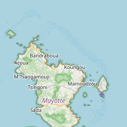

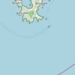


Major cities in the vicinity of Bouéni, Mayotte
Bandrele ... (12 Km)
Dembeni ... (14 Km)
Mamoudzou ... (22 Km)
Bandraboua ... (23 Km)
Koungou ... (24 Km)
Pamandzi ... (25 Km)
Moroni ... (240 Km)
Mahajanga ... (339 Km)
Ambanja ... (375 Km)
Antsiranana ... (462 Km)
Pemba ... (495 Km)
Nacala ... (509 Km)
Vohemar ... (535 Km)
Sambava ... (569 Km)
Mtwara ... (608 Km)
Ambatondrazaka ... (654 Km)
Montepuez ... (659 Km)
Angoche ... (668 Km)
Nampula ... (674 Km)
Fenoarivo Atsinanana ... (680 Km)
Arivonimamo ... (714 Km)
Antananarivo ... (716 Km)
Moramanga ... (751 Km)
Ambatolampy ... (762 Km)
Ambositra ... (879 Km)
Note: The distance between two locations is provided as an aerial distance for informational purposes only. While approximate, this calculation is based on reliable data and may vary slightly from the actual distance as reported in official forecasts and advisories.


