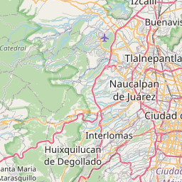
Current Local Time in Tlalnepantla, México, Mexico (Tlalnepantla de Baz)
18:48:24
Saturday, 26 July 2025
| Country: | Mexico |
| State: | México (ME) |
| Languages: | Spanish, Nahuatl, Yucatec Maya |
| Currency: | Mexican Peso (MXN) |
| Lat/Long: | 19.5345°N / 99.1907°W |
| Elevation: | 2250 m |
| Country Code: | +52 |
Weather
°C
Change Units for Weather
Now

Light rain
21 °C
Sun, 27

Heavy rain
21 / 13 °C
Mon, 28

Moderate rain
22 / 9 °C
Tue, 29

Patchy rain nearby
22 / 9 °C
Time Zone


No DST
No Daylight Saving Time in 2025
Sun & Moon

Sunrise
06:11

Sunset
19:15

Day length
13 hours, 03 minutes -44s shorter

Moon 2%
Rise - 08:54 Set - 21:56
Time Zone ConverterCompare the local time of two time zones, countries or cities of the world |  |
Tlalnepantla
Time Difference to major World Cities
Upcoming Holidays
Tuesday, September 16, 2025 Independence Day
Monday, November 17, 2025 Revolution Day
Friday, December 12, 2025 Day of the Virgin of Guadalupe
Thursday, December 25, 2025 Christmas Day
Thursday, January 1, 2026 New Year's Day
Airports
Licenciado Benito Juarez International Airport, MEX About 17 km from Tlalnepantla
Felipe Ángeles International Airport, NLU About 30 km from Tlalnepantla
Licenciado Adolfo López Mateos International Airport, TLC About 45 km from Tlalnepantla
Cuernavaca - General Mariano Matamoros Airport, CVJ About 78 km from Tlalnepantla
Hermanos Serdán International Airport, PBC About 96 km from Tlalnepantla
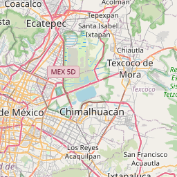
See on the Map

Major cities in the vicinity of Tlalnepantla, Mexico
Mexico City ... (13 Km)
Toluca ... (56 Km)
Cuernavaca ... (68 Km)
Puebla ... (117 Km)
Santiago de Querétaro ... (172 Km)
Morelia ... (211 Km)
Orizaba ... (232 Km)
Xalapa ... (239 Km)
Acapulco ... (306 Km)
León ... (315 Km)
Veracruz ... (323 Km)
Tampico ... (330 Km)
Aguascalientes ... (415 Km)
Guadalajara ... (452 Km)
Coatzacoalcos ... (522 Km)
Tepic ... (633 Km)
Mezcales ... (650 Km)
Villahermosa ... (679 Km)
Saltillo ... (682 Km)
Monterrey ... (694 Km)
Tuxtla Gutiérrez ... (714 Km)
Matamoros ... (725 Km)
Reynosa ... (730 Km)
McAllen ... (748 Km)
Durango ... (753 Km)
San Cristóbal de las Casas ... (759 Km)
Ciudad del Carmen ... (782 Km)
Torreón ... (796 Km)
Monclova ... (851 Km)
Note: The distance between two locations is provided as an aerial distance for informational purposes only. While approximate, this calculation is based on reliable data and may vary slightly from the actual distance as reported in official forecasts and advisories.


