Current Local Time in Pathein, Myanmar
00:25:56
Monday, 21 July 2025
| Country: | Myanmar |
| Region: | Ayeyarwady |
| Languages: | Burmese |
| Currency: | Kyat (MMK) |
| Lat/Long: | 16.7754°N / 94.7381°E |
| Elevation: | 6 m |
| Country Code: | +95 |
Weather
°C
Change Units for Weather
Now

Partly Cloudy
26 °C
Tue, 22

Heavy rain
26 / 25 °C
Wed, 23
Heavy rain
27 / 25 °C
Thu, 24

Moderate rain
30 / 26 °C
Time Zone


No DST
No Daylight Saving Time in 2025
Sun & Moon

Sunrise
05:48

Sunset
18:46

Day length
12 hours, 58 minutes -33s shorter

Moon 18%
Rise - 01:52 Set - 15:35
Time Zone ConverterCompare the local time of two time zones, countries or cities of the world |  |
Pathein
Time Difference to major World Cities
Upcoming Holidays
Sunday, October 5, 2025 Full Moon Day of Thadingyut Holiday (Buddhist Lent ends)
Monday, October 6, 2025 Full Moon Day of Thadingyut Holiday (Buddhist Lent ends)
Tuesday, October 7, 2025 Full Moon Day of Thadingyut Holiday (Buddhist Lent ends)
Wednesday, October 8, 2025 Full Moon Day of Thadingyut Holiday (Buddhist Lent ends)
Tuesday, November 4, 2025 Full Moon Day of Tazaungmone
Airports
Yangon International Airport, RGN About 149 km from Pathein
Thandwe Airport, SNW About 193 km from Pathein
Kyaukpyu Airport, KYP About 321 km from Pathein
Nay Pyi Taw International Airport, NYT About 352 km from Pathein
Mae Sot Airport, MAQ About 405 km from Pathein
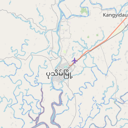
See on the Map


Major cities in the vicinity of Pathein, Myanmar
Yangon ... (151 Km)
Bago ... (194 Km)
Pyay ... (233 Km)
Hpa-An ... (309 Km)
Mawlamyine ... (312 Km)
Naypyidaw ... (361 Km)
Mae Sot ... (409 Km)
Chiang Mai ... (502 Km)
Taunggyi ... (507 Km)
Lampang ... (532 Km)
Nakhon Sawan ... (587 Km)
Mandalay ... (594 Km)
Monywa ... (594 Km)
Kanchanaburi ... (598 Km)
Myeik ... (637 Km)
Nakhon Pathom ... (657 Km)
Chittagong ... (689 Km)
Samut Sakhon ... (694 Km)
Bangkok ... (703 Km)
Samut Prakan ... (722 Km)
Lashio ... (754 Km)
Laem Chabang ... (779 Km)
Pattaya ... (787 Km)
Barisal ... (802 Km)
Note: The distance between two locations is provided as an aerial distance for informational purposes only. While approximate, this calculation is based on reliable data and may vary slightly from the actual distance as reported in official forecasts and advisories.


