Current Local Time in Ila Orangun, Osun, Nigeria (Ila)
1
2
3
4
5
6
7
8
9
10
11
12
08:52:25
Friday, 4 July 2025
| Country: | Nigeria |
| State: | Osun (OS) |
| Languages: | English |
| Currency: | Naira (NGN) |
| Lat/Long: | 8.0121°N / 4.8988°E |
| Elevation: | 496 m |
| Country Code: | +234 |
Weather
°C
Change Units for Weather
Now

Patchy rain nearby
23 °C
Sat, 5

Moderate rain
24 / 20 °C
Sun, 6
Patchy rain nearby
26 / 19 °C
Mon, 7
Patchy rain nearby
27 / 20 °C
Time Zone


No DST
No Daylight Saving Time in 2025
Sun & Moon

Sunrise
06:27

Sunset
19:01

Day length
12 hours, 33 minutes -6s shorter

Moon 61%
Rise - 13:52 Set - 01:13
Time Zone ConverterCompare the local time of two time zones, countries or cities of the world |  |
Ila Orangun
Time Difference to major World Cities
Upcoming Holidays
Wednesday, August 20, 2025 Isese Day
Friday, September 5, 2025 Id el Maulud
Wednesday, October 1, 2025 National Day
Thursday, December 25, 2025 Christmas Day
Friday, December 26, 2025 Boxing Day
Airports
Ilorin International Airport, ILR About 65 km from Ila Orangun
Akure Airport, AKR About 96 km from Ila Orangun
Ibadan Airport, IBA About 125 km from Ila Orangun
Benin Airport, BNI About 204 km from Ila Orangun
Murtala Muhammed International Airport, LOS About 236 km from Ila Orangun
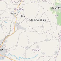
See on the Map

Major cities in the vicinity of Ila Orangun, Nigeria
Ilorin ... (66 Km)
Ibadan ... (129 Km)
Benin City ... (202 Km)
Lagos ... (240 Km)
Tchaourou ... (272 Km)
Asaba ... (287 Km)
Parakou ... (292 Km)
Warri ... (293 Km)
Porto-Novo ... (302 Km)
Abuja ... (307 Km)
Cotonou ... (328 Km)
Enugu ... (335 Km)
Owerri ... (365 Km)
Kaduna ... (393 Km)
Makurdi ... (402 Km)
Sokodé ... (427 Km)
Port Harcourt ... (428 Km)
Kara ... (441 Km)
Lomé ... (456 Km)
Natitingou ... (462 Km)
Zaria ... (464 Km)
Jos ... (487 Km)
Gusau ... (501 Km)
Sokoto ... (563 Km)
Kano ... (595 Km)
Bauchi ... (600 Km)
Tema ... (601 Km)
Koforidua ... (608 Km)
Bamenda ... (623 Km)
Accra ... (626 Km)
Note: The distance between two locations is provided as an aerial distance for informational purposes only. While approximate, this calculation is based on reliable data and may vary slightly from the actual distance as reported in official forecasts and advisories.