Current Local Time in Sabanitas, Panama
23:00:26
Wednesday, 23 July 2025
| Country: | Panama |
| Province: | Colón |
| Languages: | Spanish |
| Currency: | Balboa (PAB) |
| Lat/Long: | 9.3451°N / 79.8045°W |
| Elevation: | 27 m |
| Country Code: | +507 |
Weather
°C
Change Units for Weather
Now

Partly cloudy
27 °C
Thu, 24

Moderate rain
28 / 25 °C
Fri, 25
Moderate rain
27 / 25 °C
Sat, 26
Moderate rain
28 / 24 °C
Time Zone


No DST
No Daylight Saving Time in 2025
Sun & Moon

Sunrise
06:08

Sunset
18:42

Day length
12 hours, 34 minutes -19s shorter

Moon 4%
Rise - 04:52 Set - 18:01
Time Zone ConverterCompare the local time of two time zones, countries or cities of the world |  |
Sabanitas
Time Difference to major World Cities
Upcoming Holidays
Friday, August 15, 2025 Foundation of Old Panama City
Monday, November 3, 2025 Independence Day
Tuesday, November 4, 2025 National Symbols Day
Wednesday, November 5, 2025 Colón Day
Monday, November 10, 2025 Shout in Villa De Los Santos
Airports
Enrique Adolfo Jimenez Airport, ONX About 7 km from Sabanitas
Marcos A. Gelabert International Airport, PAC About 50 km from Sabanitas
Tocumen International Airport, PTY About 55 km from Sabanitas
Alonso Valderrama Airport, CTD About 165 km from Sabanitas
Ruben Cantu Airport, SYP About 188 km from Sabanitas
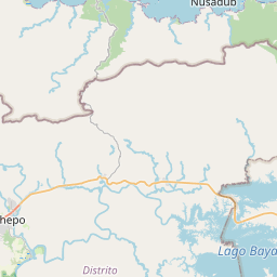
See on the Map
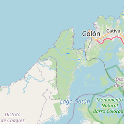


Major cities in the vicinity of Sabanitas, Panama
Colón ... (11 Km)
Panama City ... (51 Km)
La Chorrera ... (52 Km)
Aguadulce ... (147 Km)
Chitré ... (168 Km)
David ... (306 Km)
Montería ... (436 Km)
Cartago ... (454 Km)
San José ... (473 Km)
Quepos ... (478 Km)
Cartagena ... (488 Km)
Bluefields ... (525 Km)
Barranquilla ... (577 Km)
Medellín ... (580 Km)
Liberia ... (634 Km)
Puerto Cabezas ... (652 Km)
Pereira ... (678 Km)
Tuluá ... (707 Km)
Valledupar ... (729 Km)
Granada ... (731 Km)
Ibagué ... (745 Km)
Cali ... (748 Km)
Waspán ... (751 Km)
Jinotepe ... (752 Km)
Managua ... (770 Km)
Bucaramanga ... (776 Km)
Matagalpa ... (777 Km)
Riohacha ... (792 Km)
Bogotá ... (816 Km)
Note: The distance between two locations is provided as an aerial distance for informational purposes only. While approximate, this calculation is based on reliable data and may vary slightly from the actual distance as reported in official forecasts and advisories.


