Current Local Time in Shagonar, Russia
01:19:33
Sunday, 27 July 2025
| Country: | Russia |
| Republic: | Tuva |
| Languages: | Russian |
| Currency: | Russian Ruble (RUB) |
| Lat/Long: | 51.5388°N / 92.9127°E |
| Elevation: | 560 m |
| Country Code: | +7 |
Weather
°C
Change Units for Weather
Now

Clear
14 °C
Mon, 28

Patchy rain nearby
33 / 14 °C
Tue, 29
Patchy rain nearby
31 / 13 °C
Wed, 30
Patchy rain nearby
31 / 13 °C
Time Zone


No DST
No Daylight Saving Time in 2025
Sun & Moon

Sunrise
05:05

Sunset
20:44

Day length
15 hours, 39 minutes -2m 53s shorter

Moon 6%
Rise - 07:48 Set - 21:58
Time Zone ConverterCompare the local time of two time zones, countries or cities of the world |  |
Shagonar
Time Difference to major World Cities
Upcoming Holidays
Monday, November 3, 2025 Unity Day Holiday
Tuesday, November 4, 2025 Unity Day
Wednesday, December 31, 2025 Substitute Holiday for New Year Holiday
Thursday, January 1, 2026 New Year's Day
Friday, January 2, 2026 New Year Holiday
Airports
Kyzyl Airport, KYZ About 104 km from Shagonar
Abakan International Airport, ABA About 266 km from Shagonar
Khovd Airport, HVD About 409 km from Shagonar
Spichenkovo Airport, NOZ About 479 km from Shagonar
Gorno-Altaysk Airport, RGK About 489 km from Shagonar
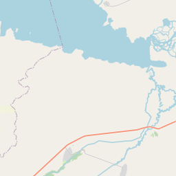
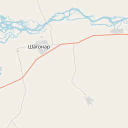
See on the Map


Major cities in the vicinity of Shagonar, Russia
Abakan ... (262 Km)
Ölgii ... (354 Km)
Khovd ... (406 Km)
Novokuznetsk ... (462 Km)
Gorno-Altaysk ... (481 Km)
Prokopyevsk ... (492 Km)
Krasnoyarsk ... (498 Km)
Altay ... (537 Km)
Nizhneudinsk ... (552 Km)
Mörön ... (553 Km)
Kemerovo ... (620 Km)
Altai ... (626 Km)
Barnaul ... (650 Km)
Oskemen ... (746 Km)
Tomsk ... (757 Km)
Bratsk ... (764 Km)
Novosibirsk ... (768 Km)
Irkutsk ... (784 Km)
Erdenet ... (838 Km)
Note: The distance between two locations is provided as an aerial distance for informational purposes only. While approximate, this calculation is based on reliable data and may vary slightly from the actual distance as reported in official forecasts and advisories.


