Current Local Time in Tashtagol, Russia
07:29:02
Sunday, 27 July 2025
| Country: | Russia |
| Oblast: | Kemerovo |
| Languages: | Russian |
| Currency: | Russian Ruble (RUB) |
| Lat/Long: | 52.7591°N / 87.8473°E |
| Elevation: | 464 m |
| Country Code: | +7 |
Weather
°C
Change Units for Weather
Now

Sunny
15 °C
Mon, 28
Sunny
29 / 10 °C
Tue, 29

Moderate rain
31 / 14 °C
Wed, 30

Patchy rain nearby
31 / 16 °C
Time Zone


No DST
No Daylight Saving Time in 2025
Sun & Moon

Sunrise
05:20

Sunset
21:09

Day length
15 hours, 49 minutes -3m 3s shorter

Moon 6%
Rise - 08:01 Set - 22:16
Time Zone ConverterCompare the local time of two time zones, countries or cities of the world |  |
Tashtagol
Time Difference to major World Cities
Upcoming Holidays
Monday, November 3, 2025 Unity Day Holiday
Tuesday, November 4, 2025 Unity Day
Wednesday, December 31, 2025 Substitute Holiday for New Year Holiday
Thursday, January 1, 2026 New Year's Day
Friday, January 2, 2026 New Year Holiday
Airports
Spichenkovo Airport, NOZ About 134 km from Tashtagol
Gorno-Altaysk Airport, RGK About 162 km from Tashtagol
Abakan International Airport, ABA About 259 km from Tashtagol
Barnaul Airport, BAX About 296 km from Tashtagol
Kemerovo Airport, KEJ About 301 km from Tashtagol
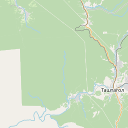
See on the Map


Major cities in the vicinity of Tashtagol, Russia
Novokuznetsk ... (121 Km)
Prokopyevsk ... (146 Km)
Gorno-Altaysk ... (156 Km)
Abakan ... (261 Km)
Barnaul ... (279 Km)
Kemerovo ... (310 Km)
Novosibirsk ... (409 Km)
Ölgii ... (447 Km)
Tomsk ... (455 Km)
Oskemen ... (479 Km)
Krasnoyarsk ... (487 Km)
Altay ... (549 Km)
Semey ... (586 Km)
Khovd ... (595 Km)
Karasuk ... (660 Km)
Kupino ... (719 Km)
Pavlodar ... (737 Km)
Nizhneudinsk ... (770 Km)
Karamay ... (827 Km)
Note: The distance between two locations is provided as an aerial distance for informational purposes only. While approximate, this calculation is based on reliable data and may vary slightly from the actual distance as reported in official forecasts and advisories.


