Current Local Time in Tambacounda, Senegal
05:17:02
Tuesday, 22 July 2025
| Country: | Senegal |
| Region: | Tambacounda |
| Languages: | French |
| Currency: | West African CFA Franc (XOF) |
| Lat/Long: | 13.7726°N / 13.6710°W |
| Elevation: | 24 m |
| Country Code: | +221 |
Weather
°C
Change Units for Weather
Now

Partly Cloudy
25 °C
Wed, 23

Heavy rain
31 / 24 °C
Thu, 24

Partly Cloudy
33 / 24 °C
Fri, 25

Sunny
33 / 24 °C
Time Zone


No DST
No Daylight Saving Time in 2025
Sun & Moon

Sunrise
06:37

Sunset
19:25

Day length
12 hours, 48 minutes -27s shorter

Moon 10%
Rise - 04:01 Set - 17:36
Time Zone ConverterCompare the local time of two time zones, countries or cities of the world |  |
Tambacounda
Time Difference to major World Cities
Upcoming Holidays
Wednesday, August 13, 2025 Grand Magal De Touba
Friday, August 15, 2025 Assumption Day
Friday, September 5, 2025 Maouloud
Saturday, November 1, 2025 All Saints' Day
Monday, November 3, 2025 All Saints' Day observed
Airports
Tambacounda Airport, TUD About 4 km from Tambacounda
Bakel Airport, BXE About 176 km from Tambacounda
Kédougou Airport, KGG About 206 km from Tambacounda
Ouro Sogui Airport, MAX About 206 km from Tambacounda
Kayes Dag Dag Airport, KYS About 257 km from Tambacounda
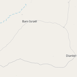
See on the Map


Major cities in the vicinity of Tambacounda, Senegal
Kolda ... (169 Km)
Farim ... (220 Km)
Kayes ... (251 Km)
Mbacké ... (266 Km)
Touba ... (269 Km)
Bissau ... (297 Km)
Labé ... (311 Km)
Ziguinchor ... (311 Km)
Banjul ... (316 Km)
Boké ... (322 Km)
Serekunda ... (327 Km)
Catió ... (327 Km)
Aleg ... (366 Km)
Thiès ... (370 Km)
Saint-Louis ... (393 Km)
Kiffa ... (400 Km)
Mamou ... (415 Km)
Dakar ... (420 Km)
Kindia ... (424 Km)
Conakry ... (460 Km)
Nouakchott ... (539 Km)
Siguiri ... (553 Km)
Freetown ... (592 Km)
Kankan ... (606 Km)
Waterloo ... (609 Km)
Bamako ... (626 Km)
Kissidougou ... (642 Km)
Koidu ... (642 Km)
Akjoujt ... (669 Km)
Bo ... (680 Km)
Note: The distance between two locations is provided as an aerial distance for informational purposes only. While approximate, this calculation is based on reliable data and may vary slightly from the actual distance as reported in official forecasts and advisories.


