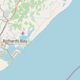
Current Local Time in Richards Bay, South Africa
03:15:39
Monday, 28 July 2025
| Country: | South Africa |
| Province: | KwaZulu-Natal |
| Languages: | Zulu, English, Xhosa, Afrikaans |
| Currency: | Rand (ZAR) |
| Lat/Long: | 28.7694°S / 32.0594°E |
| Elevation: | 9 m |
| Country Code: | +27 |
Weather
°C
Change Units for Weather
Now

Patchy rain nearby
15 °C
Tue, 29

Sunny
21 / 13 °C
Wed, 30
Sunny
23 / 15 °C
Thu, 31
Sunny
25 / 16 °C
Time Zone


No DST
No Daylight Saving Time in 2025
Sun & Moon

Sunrise
06:37

Sunset
17:18

Day length
10 hours, 41 minutes +1m 8s longer

Moon 11%
Rise - 08:54 Set - 20:59
Time Zone ConverterCompare the local time of two time zones, countries or cities of the world |  |
Richards Bay
Time Difference to major World Cities
Upcoming Holidays
Saturday, August 9, 2025 National Women's Day
Wednesday, September 24, 2025 Heritage Day
Tuesday, December 16, 2025 Day of Reconciliation
Thursday, December 25, 2025 Christmas Day
Friday, December 26, 2025 Day of Goodwill
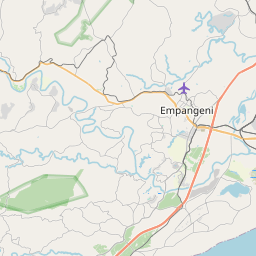
Airports
Richards Bay Airport, RCB About 4 km from Richards Bay
Prince Mangosuthu Buthelezi Airport, ULD About 80 km from Richards Bay
Mkuze Airport, MZQ About 127 km from Richards Bay
King Shaka International Airport, DUR About 131 km from Richards Bay
Virginia Airport, VIR About 148 km from Richards Bay
See on the Map
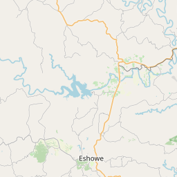


Major cities in the vicinity of Richards Bay, South Africa
Durban ... (157 Km)
Pietermaritzburg ... (187 Km)
Newcastle ... (237 Km)
Manzini ... (260 Km)
Lobamba ... (277 Km)
Mbabane ... (288 Km)
Maputo ... (315 Km)
Thaba-Tseka ... (345 Km)
Mbombela ... (382 Km)
Xai-Xai ... (443 Km)
Maseru ... (449 Km)
Boksburg ... (470 Km)
Johannesburg ... (488 Km)
Pretoria ... (509 Km)
Bloemfontein ... (570 Km)
Klerksdorp ... (571 Km)
Rustenburg ... (588 Km)
Polokwane ... (601 Km)
East London ... (617 Km)
Inhambane ... (638 Km)
Kimberley ... (712 Km)
Gaborone ... (764 Km)
Vilankulos ... (821 Km)
Note: The distance between two locations is provided as an aerial distance for informational purposes only. While approximate, this calculation is based on reliable data and may vary slightly from the actual distance as reported in official forecasts and advisories.


