Current Local Time in Er Roseires, Sudan
20:13:09
Tuesday, 22 July 2025
| Country: | Sudan |
| State: | Blue Nile (NB) |
| Languages: | Arabic, English |
| Currency: | Sudanese Pound (SDG) |
| Lat/Long: | 11.8640°N / 34.3882°E |
| Elevation: | 467 m |
| Country Code: | +249 |
Weather
°C
Change Units for Weather
Now

Clear
29 °C
Wed, 23

Patchy rain nearby
31 / 23 °C
Thu, 24
Patchy rain nearby
29 / 23 °C
Fri, 25

Partly Cloudy
32 / 24 °C
Time Zone


No DST
No Daylight Saving Time in 2025
Sun & Moon

Sunrise
05:27

Sunset
18:10

Day length
12 hours, 42 minutes -23s shorter

Moon 10%
Rise - 02:45 Set - 16:10
Time Zone ConverterCompare the local time of two time zones, countries or cities of the world |  |
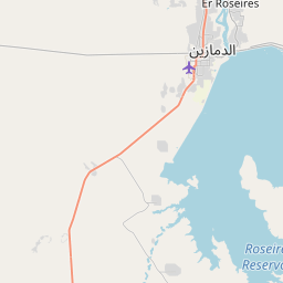
Er Roseires
Time Difference to major World Cities
Upcoming Holidays
Friday, September 5, 2025 The Prophet's Birthday
Thursday, December 25, 2025 Christmas Day
Thursday, January 1, 2026 Independence Day
Wednesday, January 7, 2026 Coptic Christmas
Friday, March 20, 2026 Eid al-Fitr
Airports
Asosa Airport, ASO About 206 km from Er Roseires
Bahir Dar Airport, BJR About 321 km from Er Roseires
Gonder Airport, GDQ About 339 km from Er Roseires
Malakal Airport, MAK About 394 km from Er Roseires
Gambella Airport, GMB About 416 km from Er Roseires
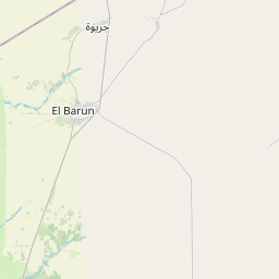
See on the Map


Major cities in the vicinity of Er Roseires, Sudan
Sennar ... (205 Km)
Rabak ... (230 Km)
Kosti ... (235 Km)
Al Qadarif ... (264 Km)
Wad Madani ... (296 Km)
Al Managil ... (305 Km)
Bahir Dar ... (326 Km)
Gondar ... (343 Km)
Umm Ruwaba ... (362 Km)
Malakal ... (395 Km)
Gambela ... (403 Km)
New Halfa ... (407 Km)
Khartoum ... (450 Km)
Kassala ... (454 Km)
El-Obeid ... (476 Km)
Dalang ... (516 Km)
Axum ... (533 Km)
Jimma ... (538 Km)
Shendi ... (546 Km)
Akordat ... (557 Km)
Addis Ababa ... (574 Km)
Mekele ... (580 Km)
Bentiu ... (581 Km)
Keren ... (618 Km)
Asmara ... (623 Km)
Atbara ... (650 Km)
En Nahud ... (654 Km)
Massawa ... (687 Km)
Hawassa ... (700 Km)
Bor ... (701 Km)
Note: The distance between two locations is provided as an aerial distance for informational purposes only. While approximate, this calculation is based on reliable data and may vary slightly from the actual distance as reported in official forecasts and advisories.


