Current Local Time in Suran, Syria
03:42:04
Friday, 25 July 2025
| Country: | Syria |
| Governorate: | Hama |
| Languages: | Arabic |
| Currency: | Syrian Pound (SYP) |
| Lat/Long: | 35.2900°N / 36.7475°E |
| Elevation: | 350 m |
| Country Code: | +963 |
Weather
°C
Change Units for Weather
Now

Clear
25 °C
Sat, 26

Sunny
41 / 24 °C
Sun, 27
Sunny
42 / 27 °C
Mon, 28
Sunny
41 / 26 °C
Time Zone


No DST
No Daylight Saving Time in 2025
Sun & Moon

Sunrise
05:37

Sunset
19:41

Day length
14 hours, 04 minutes -1m 27s shorter

Moon 0%
Rise - 05:55 Set - 20:27
Time Zone ConverterCompare the local time of two time zones, countries or cities of the world |  |
Suran
Time Difference to major World Cities
Upcoming Holidays
Friday, September 5, 2025 The Prophet's Birthday
Monday, October 6, 2025 October Liberation Day
Thursday, December 25, 2025 Christmas Day
Thursday, January 1, 2026 New Year's Day
Sunday, March 8, 2026 Revolution Day
Airports
Bassel Al-Assad International Airport, LTK About 73 km from Suran
Rene Mouawad Air Base, KYE About 103 km from Suran
Aleppo International Airport, ALP About 108 km from Suran
Hatay Airport, HTY About 126 km from Suran
Palmyra Airport, PMS About 165 km from Suran
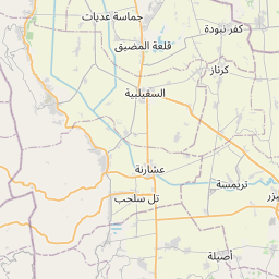
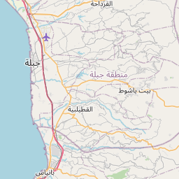
See on the Map
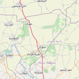


Major cities in the vicinity of Suran, Syria
Hama ... (17 Km)
Salamiyah ... (42 Km)
Masyaf ... (45 Km)
Homs ... (62 Km)
Idlib ... (72 Km)
Baniyas ... (73 Km)
Tartus ... (90 Km)
Latakia ... (91 Km)
As-Safira ... (105 Km)
Aleppo ... (108 Km)
Tripoli ... (126 Km)
Afrin ... (136 Km)
Al-Bab ... (139 Km)
An-Nabek ... (142 Km)
Yabroud ... (147 Km)
Baalbek ... (151 Km)
Batroun ... (152 Km)
İskenderun ... (153 Km)
Palmyra ... (162 Km)
Byblos ... (164 Km)
Al-Thawrah ... (173 Km)
Manbij ... (175 Km)
Zahlé ... (178 Km)
Jounieh ... (180 Km)
Beirut ... (193 Km)
Damascus ... (202 Km)
Jarabulus ... (204 Km)
Gaziantep ... (205 Km)
Ceyhan ... (211 Km)
Raqqa ... (217 Km)
Note: The distance between two locations is provided as an aerial distance for informational purposes only. While approximate, this calculation is based on reliable data and may vary slightly from the actual distance as reported in official forecasts and advisories.


