Current Local Time in Kibaha, Tanzania
10:31:12
Tuesday, 22 July 2025
| Country: | Tanzania |
| Region: | Pwani |
| Languages: | Swahili, English |
| Currency: | Tanzanian Shilling (TZS) |
| Lat/Long: | 6.7831°S / 38.9910°E |
| Elevation: | 138 m |
| Country Code: | +255 |
Weather
°C
Change Units for Weather
Now

Patchy rain nearby
24 °C
Wed, 23

Partly Cloudy
28 / 18 °C
Thu, 24
Patchy rain nearby
31 / 18 °C
Fri, 25
Partly Cloudy
31 / 18 °C
Time Zone


No DST
No Daylight Saving Time in 2025
Sun & Moon

Sunrise
06:37

Sunset
18:23

Day length
11 hours, 46 minutes +12s longer

Moon 10%
Rise - 04:10 Set - 16:10
Time Zone ConverterCompare the local time of two time zones, countries or cities of the world |  |
Kibaha
Time Difference to major World Cities
Upcoming Holidays
Friday, August 8, 2025 Farmers' Day
Friday, September 5, 2025 Maulid
Tuesday, October 14, 2025 Mwalimu Nyerere Day
Tuesday, December 9, 2025 Independence Day
Thursday, December 25, 2025 Christmas Day
Airports
Julius Nyerere International Airport, DAR About 26 km from Kibaha
Abeid Amani Karume International Airport, ZNZ About 68 km from Kibaha
Tanga Airport, TGT About 188 km from Kibaha
Pemba Airport, PMA About 192 km from Kibaha
Moi International Airport, MBA About 313 km from Kibaha
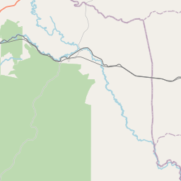
See on the Map

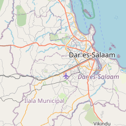


Major cities in the vicinity of Kibaha, Tanzania
Dar es Salaam ... (32 Km)
Zanzibar ... (72 Km)
Morogoro ... (147 Km)
Tanga ... (190 Km)
Mombasa ... (314 Km)
Dodoma ... (364 Km)
Mtwara ... (411 Km)
Makambako ... (513 Km)
Songea ... (568 Km)
Kitui ... (612 Km)
Mbeya ... (653 Km)
Nairobi ... (656 Km)
Montepuez ... (706 Km)
Pemba ... (708 Km)
Garissa ... (708 Km)
Tabora ... (712 Km)
Moroni ... (720 Km)
Naivasha ... (731 Km)
Mzuzu ... (753 Km)
Meru ... (774 Km)
Nanyuki ... (784 Km)
Nakuru ... (791 Km)
Mwanza ... (825 Km)
Note: The distance between two locations is provided as an aerial distance for informational purposes only. While approximate, this calculation is based on reliable data and may vary slightly from the actual distance as reported in official forecasts and advisories.


