Current Local Time in Neiafu, Tonga
10:39:41
Sunday, 20 July 2025
| Country: | Tonga |
| Languages: | Tongan, English |
| Currency: | Paʻanga (TOP) |
| Lat/Long: | 18.6477°S / 173.9837°W |
| Elevation: | 20 m |
| Country Code: | +676 |
Weather
°C
Change Units for Weather
Now

Patchy rain nearby
25 °C
Mon, 21
Patchy rain nearby
25 / 24 °C
Tue, 22
Patchy rain nearby
25 / 25 °C
Wed, 23
Patchy rain nearby
26 / 25 °C
Time Zone


No DST
No Daylight Saving Time in 2025
Sun & Moon

Sunrise
07:07

Sunset
18:16

Day length
11 hours, 09 minutes +35s longer

Moon 28%
Rise - 02:10 Set - 13:32
Time Zone ConverterCompare the local time of two time zones, countries or cities of the world |  |
Neiafu
Time Difference to major World Cities
Upcoming Holidays
Wednesday, September 17, 2025 Birthday of Crown Prince Tupouto'a-'Ulukalala
Monday, November 3, 2025 Day off for Constitution Day
Tuesday, November 4, 2025 Constitution Day
Thursday, December 4, 2025 Anniversary of the Coronation of King Tupou I
Monday, December 8, 2025 Day off for Anniversary of the Coronation of King Tupou I
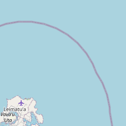
Airports
Vava'u International Airport, VAV About 7 km from Neiafu
Lifuka Island Airport, HPA About 131 km from Neiafu
Fua'amotu International Airport, TBU About 313 km from Neiafu
Niue International Airport, IUE About 430 km from Neiafu
Faleolo International Airport, APW About 576 km from Neiafu
See on the Map


Major cities in the vicinity of Neiafu, Tonga
Nuku‘alofa ... (305 Km)
Alofi ... (430 Km)
Apia ... (584 Km)
Pago Pago ... (599 Km)
Mata Utu ... (641 Km)
Suva ... (803 Km)
Funafuti ... (1345 Km)
Avarua ... (1511 Km)
Enderbury Island ... (1754 Km)
Port Vila ... (1871 Km)
Luganville ... (2029 Km)
Nouméa ... (2076 Km)
Kingston ... (2166 Km)
Whangarei ... (2220 Km)
Note: The distance between two locations is provided as an aerial distance for informational purposes only. While approximate, this calculation is based on reliable data and may vary slightly from the actual distance as reported in official forecasts and advisories.


