Current Local Time in Gafsa, Tunisia
18:55:56
Sunday, 20 July 2025
| Country: | Tunisia |
| Governorate: | Gafsa |
| Languages: | Arabic |
| Currency: | Tunisian Dinar (TND) |
| Lat/Long: | 34.4250°N / 8.7800°E |
| Elevation: | 297 m |
| Country Code: | +216 |
| Holiday Note: Jul 25 - Republic Day. The Businesses may be closed. |
Weather
°C
Change Units for Weather
Now

Sunny
41 °C
Mon, 21
Sunny
42 / 31 °C
Tue, 22
Sunny
43 / 32 °C
Wed, 23
Sunny
42 / 29 °C
Time Zone


No DST
No Daylight Saving Time in 2025
Sun & Moon

Sunrise
05:27

Sunset
19:35

Day length
14 hours, 07 minutes -1m 13s shorter

Moon 28%
Rise - 00:45 Set - 15:44
Time Zone ConverterCompare the local time of two time zones, countries or cities of the world |  |
Gafsa
Time Difference to major World Cities
Upcoming Holidays
Friday, July 25, 2025 Republic Day
Wednesday, August 13, 2025 Women’s Day
Thursday, September 4, 2025 The Prophet's Birthday
Wednesday, October 15, 2025 Evacuation Day
Wednesday, December 17, 2025 Revolution and Youth Day
Airports
Gafsa Ksar International Airport, GAF About 4 km from Gafsa
Tozeur Nefta International Airport, TOE About 82 km from Gafsa
Cheikh Larbi Tébessa Airport, TEE About 127 km from Gafsa
Gabès – Matmata International Airport, GAE About 130 km from Gafsa
Sfax Thyna International Airport, SFA About 178 km from Gafsa
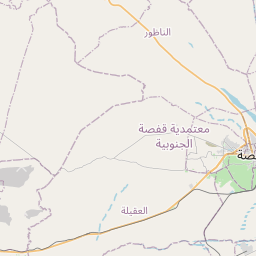
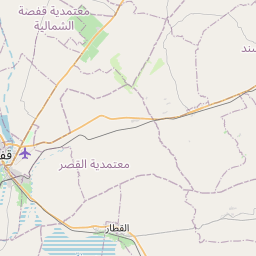
See on the Map

Major cities in the vicinity of Gafsa, Tunisia
Tozeur ... (82 Km)
Kasserine ... (83 Km)
Sidi Bouzid ... (94 Km)
El Hamma ... (111 Km)
Tébessa ... (124 Km)
Sfax ... (185 Km)
El Kef ... (194 Km)
Houmt Souk ... (201 Km)
Ghomrassen ... (209 Km)
El Oued ... (213 Km)
Sousse ... (229 Km)
Monastir ... (237 Km)
Zarzis ... (238 Km)
Béja ... (259 Km)
Batna ... (268 Km)
Biskra ... (283 Km)
Touggourt ... (291 Km)
Tunis ... (294 Km)
El Eulma ... (340 Km)
Zuwarah ... (348 Km)
Nalut ... (351 Km)
Jijel ... (381 Km)
Hassi Messaoud ... (395 Km)
Zawiya ... (410 Km)
Ouargla ... (423 Km)
Zintan ... (426 Km)
Bou Saâda ... (429 Km)
Janzur ... (431 Km)
Tripoli ... (443 Km)
Bouïra ... (493 Km)
Note: The distance between two locations is provided as an aerial distance for informational purposes only. While approximate, this calculation is based on reliable data and may vary slightly from the actual distance as reported in official forecasts and advisories.


