Current Local Time in Bellevue, Nebraska, USA
23:33:27
Monday, 28 July 2025
| Country: | United States |
| State: | Nebraska (NE) |
| Languages: | English |
| Currency: | United States Dollar (USD) |
| Lat/Long: | 41.1515°N / 95.9177°W |
| Elevation: | 305 m |
| Country Code: | +1 |
| Alternative Names: | Belleview |
Weather
°C
Change Units for Weather
Now

Clear
29 °C
Tue, 29

Sunny
41 / 23 °C
Wed, 30

Heavy rain
28 / 19 °C
Thu, 31

Partly Cloudy
30 / 18 °C
Time Zone


DST started
9 Mar 2025 Forward 1 hour From 2:00 AM to 3:00 AM

DST ends
2 Nov 2025 Back 1 hour From 2:00 AM to 1:00 AM
Sun & Moon

Sunrise
06:16

Sunset
20:43

Day length
14 hours, 27 minutes -1m 55s shorter

Moon 11%
Rise - 10:21 Set - 22:48
Time Zone ConverterCompare the local time of two time zones, countries or cities of the world |  |
Bellevue
Time Difference to major World Cities
Upcoming Holidays
Monday, September 1, 2025 Labor Day
Monday, October 13, 2025 Columbus Day
Monday, October 13, 2025 Indigenous Peoples' Day
Tuesday, November 11, 2025 Veterans Day
Thursday, November 27, 2025 Thanksgiving Day
Airports
Eppley Airfield, OMA About 17 km from Bellevue
Lincoln Airport, LNK About 78 km from Bellevue
Sioux Gateway Airport, SUX About 144 km from Bellevue
Karl Stefan Memorial Airport, OFK About 157 km from Bellevue
Rosecrans Memorial Airport, STJ About 176 km from Bellevue
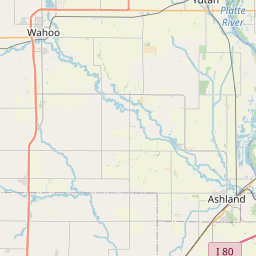
See on the Map
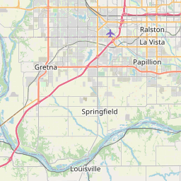
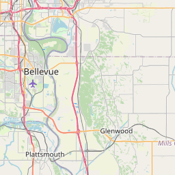


Major cities in the vicinity of Bellevue, USA
Omaha ... (12 Km)
Lincoln ... (76 Km)
Des Moines ... (197 Km)
Grand Island ... (205 Km)
Manhattan ... (226 Km)
Kansas City ... (255 Km)
Olathe ... (269 Km)
Kearney ... (271 Km)
Sioux Falls ... (275 Km)
Cedar Rapids ... (365 Km)
Hays ... (385 Km)
Columbia ... (391 Km)
Wichita ... (404 Km)
North Platte ... (405 Km)
Rochester ... (425 Km)
Davenport ... (448 Km)
Buffalo ... (477 Km)
Minneapolis ... (477 Km)
Springfield ... (493 Km)
Saint Cloud ... (510 Km)
Dodge City ... (516 Km)
Aberdeen ... (523 Km)
Peoria ... (534 Km)
Eau Claire ... (543 Km)
Bentonville ... (552 Km)
Springfield ... (552 Km)
Tulsa ... (556 Km)
St. Louis ... (563 Km)
Madison ... (578 Km)
Rockford ... (580 Km)
Note: The distance between two locations is provided as an aerial distance for informational purposes only. While approximate, this calculation is based on reliable data and may vary slightly from the actual distance as reported in official forecasts and advisories.


