Current Local Time in Grain Valley, Missouri, USA
22:51:29
Sunday, 27 July 2025
| Country: | United States |
| State: | Missouri (MO) |
| Languages: | English |
| Currency: | United States Dollar (USD) |
| Lat/Long: | 39.0150°N / 94.1986°W |
| Elevation: | 242 m |
| Country Code: | +1 |
Weather
°C
Change Units for Weather
Now

Clear
31 °C
Mon, 28

Sunny
37 / 24 °C
Tue, 29
Sunny
38 / 26 °C
Wed, 30

Patchy rain nearby
35 / 23 °C
Time Zone


DST started
9 Mar 2025 Forward 1 hour From 2:00 AM to 3:00 AM

DST ends
2 Nov 2025 Back 1 hour From 2:00 AM to 1:00 AM
Sun & Moon

Sunrise
06:14

Sunset
20:32

Day length
14 hours, 18 minutes -1m 45s shorter

Moon 6%
Rise - 09:12 Set - 22:20
Time Zone ConverterCompare the local time of two time zones, countries or cities of the world |  |
Grain Valley
Time Difference to major World Cities
Upcoming Holidays
Monday, September 1, 2025 Labor Day
Monday, October 13, 2025 Columbus Day
Tuesday, November 11, 2025 Veterans Day
Thursday, November 27, 2025 Thanksgiving Day
Thursday, December 25, 2025 Christmas Day
Airports
Charles B. Wheeler Downtown Airport, MKC About 36 km from Grain Valley
Kansas City International Airport, MCI About 54 km from Grain Valley
Rosecrans Memorial Airport, STJ About 104 km from Grain Valley
Philip Billard Municipal Airport, TOP About 123 km from Grain Valley
Topeka Regional Airport, FOE About 127 km from Grain Valley
See on the Map
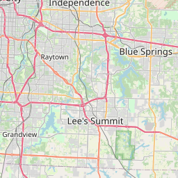

Major cities in the vicinity of Grain Valley, USA
Kansas City ... (34 Km)
Olathe ... (56 Km)
Columbia ... (161 Km)
Manhattan ... (206 Km)
Springfield ... (216 Km)
Des Moines ... (290 Km)
Omaha ... (290 Km)
Lincoln ... (293 Km)
Bentonville ... (294 Km)
Wichita ... (310 Km)
Fayetteville ... (328 Km)
St. Louis ... (349 Km)
Tulsa ... (355 Km)
Cedar Rapids ... (393 Km)
Springfield ... (400 Km)
Grand Island ... (412 Km)
Davenport ... (415 Km)
Peoria ... (435 Km)
Hays ... (444 Km)
Kearney ... (457 Km)
Conway ... (463 Km)
Jonesboro ... (469 Km)
Oklahoma City ... (492 Km)
Norman ... (510 Km)
Champaign ... (525 Km)
Dodge City ... (526 Km)
Paducah ... (535 Km)
Sioux Falls ... (546 Km)
Rockford ... (562 Km)
Rochester ... (574 Km)
Note: The distance between two locations is provided as an aerial distance for informational purposes only. While approximate, this calculation is based on reliable data and may vary slightly from the actual distance as reported in official forecasts and advisories.


