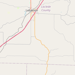
Current Local Time in Lebanon, Missouri, USA
00:47:02
Tuesday, 29 July 2025
| Country: | United States |
| State: | Missouri (MO) |
| Languages: | English |
| Currency: | United States Dollar (USD) |
| Lat/Long: | 37.6806°N / 92.6638°W |
| Elevation: | 390 m |
| Country Code: | +1 |
Weather
°C
Change Units for Weather
Now

Clear
27 °C
Wed, 30

Thundery outbreaks in nearby
34 / 22 °C
Thu, 31

Overcast
24 / 18 °C
Fri, 1

Cloudy
25 / 17 °C
Time Zone


DST started
9 Mar 2025 Forward 1 hour From 2:00 AM to 3:00 AM

DST ends
2 Nov 2025 Back 1 hour From 2:00 AM to 1:00 AM
Sun & Moon

Sunrise
06:12

Sunset
20:21

Day length
14 hours, 08 minutes -1m 43s shorter

Moon 18%
Rise - 11:09 Set - 22:57
Time Zone ConverterCompare the local time of two time zones, countries or cities of the world |  |
Lebanon
Time Difference to major World Cities
Upcoming Holidays
Monday, September 1, 2025 Labor Day
Monday, October 13, 2025 Columbus Day
Tuesday, November 11, 2025 Veterans Day
Thursday, November 27, 2025 Thanksgiving Day
Thursday, December 25, 2025 Christmas Day
Airports
Waynesville-St. Robert Regional Forney field, TBN About 47 km from Lebanon
Springfield Branson National Airport, SGF About 80 km from Lebanon
Columbia Regional Airport, COU About 132 km from Lebanon
Ozark Regional Airport, WMH About 147 km from Lebanon
Boone County Airport, HRO About 164 km from Lebanon
See on the Map

Major cities in the vicinity of Lebanon, USA
Springfield ... (76 Km)
Columbia ... (144 Km)
Bentonville ... (200 Km)
Fayetteville ... (224 Km)
Kansas City ... (230 Km)
Olathe ... (231 Km)
St. Louis ... (240 Km)
Jonesboro ... (269 Km)
Conway ... (289 Km)
Tulsa ... (341 Km)
Springfield ... (351 Km)
Paducah ... (365 Km)
Manhattan ... (379 Km)
Wichita ... (411 Km)
Peoria ... (427 Km)
Des Moines ... (442 Km)
Evansville ... (448 Km)
Vincennes ... (462 Km)
Davenport ... (463 Km)
Champaign ... (469 Km)
Cedar Rapids ... (485 Km)
Clarksville ... (487 Km)
Omaha ... (487 Km)
Owensboro ... (488 Km)
Lincoln ... (492 Km)
Oklahoma City ... (498 Km)
Terre Haute ... (498 Km)
Norman ... (507 Km)
Nashville ... (549 Km)
Bowling Green ... (555 Km)
Note: The distance between two locations is provided as an aerial distance for informational purposes only. While approximate, this calculation is based on reliable data and may vary slightly from the actual distance as reported in official forecasts and advisories.


