Current Local Time in Riverside, Illinois, USA
22:39:16
Thursday, 24 July 2025
| Country: | United States |
| State: | Illinois (IL) |
| Languages: | English |
| Currency: | United States Dollar (USD) |
| Lat/Long: | 41.8350°N / 87.8228°W |
| Elevation: | 188 m |
| Country Code: | +1 |
Weather
°C
Change Units for Weather
Now

Partly cloudy
26 °C
Fri, 25

Moderate rain
29 / 21 °C
Sat, 26

Overcast
31 / 20 °C
Sun, 27
Moderate rain
33 / 24 °C
Time Zone


DST started
9 Mar 2025 Forward 1 hour From 2:00 AM to 3:00 AM

DST ends
2 Nov 2025 Back 1 hour From 2:00 AM to 1:00 AM
Sun & Moon

Sunrise
05:38

Sunset
20:17

Day length
14 hours, 38 minutes -1m 50s shorter

Moon 1%
Rise - 05:04 Set - 20:41
Time Zone ConverterCompare the local time of two time zones, countries or cities of the world |  |
Riverside
Time Difference to major World Cities
Upcoming Holidays
Monday, September 1, 2025 Labor Day
Monday, October 13, 2025 Columbus Day
Tuesday, November 4, 2025 Election Day
Tuesday, November 11, 2025 Veterans Day
Thursday, November 27, 2025 Thanksgiving Day
Airports
Chicago O'Hare International Airport, ORD About 17 km from Riverside
Chicago Executive Airport, PWK About 32 km from Riverside
Dupage Airport, DPA About 36 km from Riverside
Gary Chicago International Airport, GYY About 42 km from Riverside
Chicago Midway International Airport, MDW About 8 km from Riverside
See on the Map
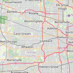
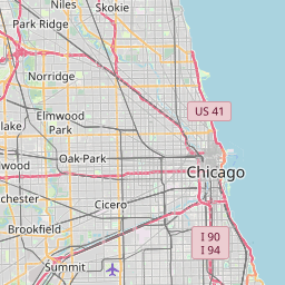


Major cities in the vicinity of Riverside, USA
Chicago ... (17 Km)
Naperville ... (29 Km)
Rockford ... (116 Km)
South Bend ... (131 Km)
Milwaukee ... (134 Km)
Lafayette ... (177 Km)
Madison ... (189 Km)
Kalamazoo ... (191 Km)
Champaign ... (194 Km)
Peoria ... (195 Km)
Grand Rapids ... (217 Km)
Davenport ... (231 Km)
Fort Wayne ... (239 Km)
Terre Haute ... (266 Km)
Indianapolis ... (269 Km)
Appleton ... (274 Km)
Muncie ... (274 Km)
Springfield ... (275 Km)
Jackson ... (286 Km)
Greenwood ... (286 Km)
Lansing ... (287 Km)
Green Bay ... (298 Km)
Bloomington ... (316 Km)
Cedar Rapids ... (318 Km)
Ann Arbor ... (340 Km)
Vincennes ... (352 Km)
Menominee ... (364 Km)
Traverse City ... (371 Km)
Dayton ... (383 Km)
Detroit ... (398 Km)
Note: The distance between two locations is provided as an aerial distance for informational purposes only. While approximate, this calculation is based on reliable data and may vary slightly from the actual distance as reported in official forecasts and advisories.


